Synthetic Aperture Radar Earth Observation Geospatial Software
Elizabeth A. Menezes
Senior Product Engineer, Imagery & Remote Sensing
I turn research-grade radar algorithms into software people can actually use. At Esri I’m the subject matter expert for synthetic aperture radar across ArcGIS — specifying, prototyping and validating the capabilities that ship in ArcGIS Pro and Image Analyst.
Geophysics MS with InSAR deformation research, eight years across SAR signal analysis, Earth observation science and production geospatial software — and a long-running habit of making technical work legible through design.
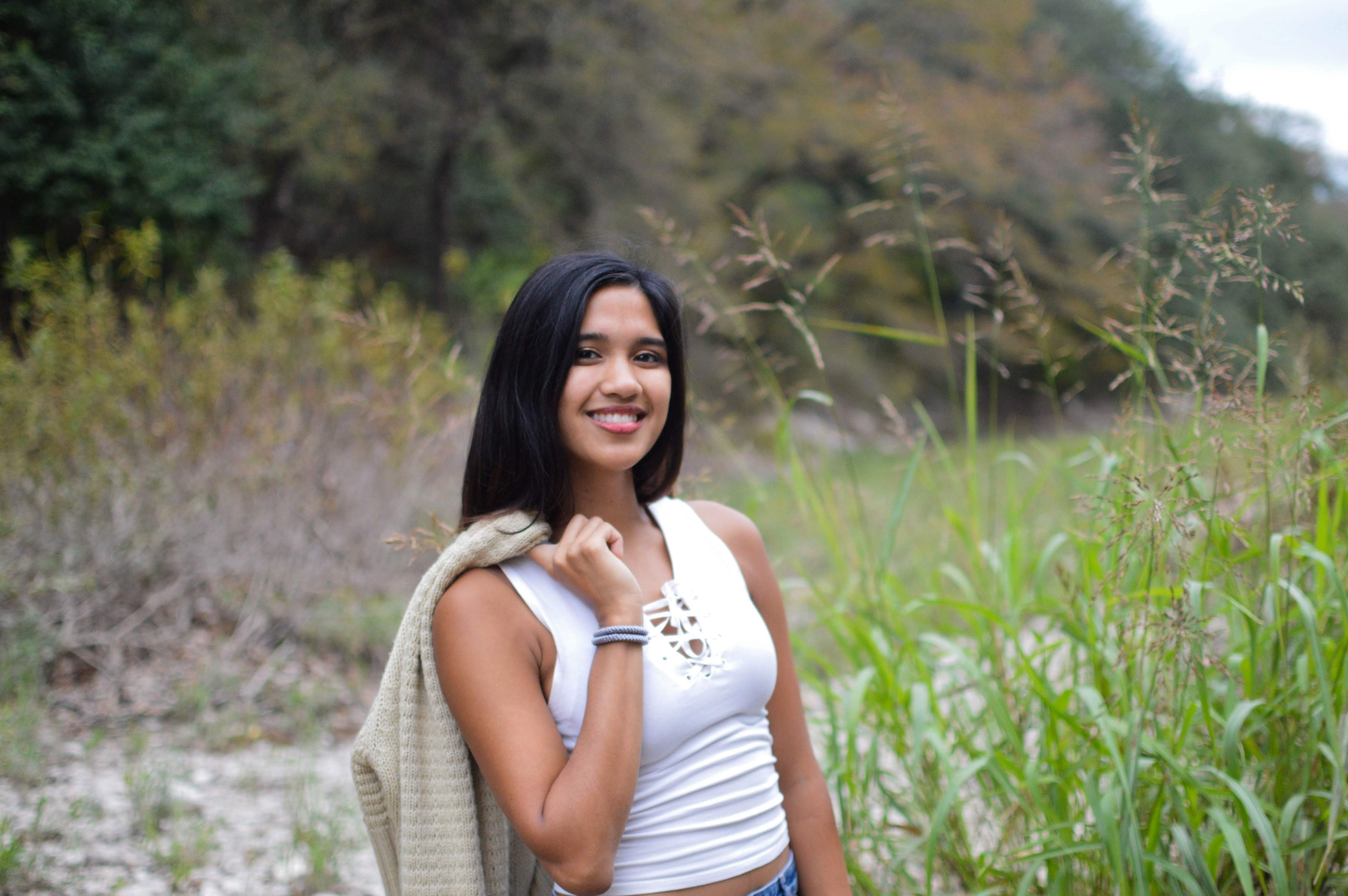
I work at the seam between research and shipped software. Radar algorithms tend to arrive as papers and prototypes; my job is to turn them into capabilities that hold up against real data, in the hands of people who are not radar specialists.
I’m a Senior Product Engineer on the Esri Imagery & Remote Sensing team, and the subject matter expert for synthetic aperture radar across ArcGIS. That means specifying processing behaviour with developers, writing Python reference implementations, and defining the test data and accuracy checks that gate each release — then validating the result against Sentinel-1, NISAR, RADARSAT-2 and commercial X-band data before it ships.
I have a B.S. in Geophysics from the University of Texas at Austin and an M.S. in Geophysics from the University of Colorado Boulder, where I processed InSAR time-series to study induced seismicity in the Raton Basin. Before that I ran real-time drilling operations in the North Sea for Halliburton, worked induced-seismicity hazard at the U.S. Bureau of Reclamation, and built museum exhibits as a science communicator at Denali National Park.
The through-line is science communication. I design as well as engineer — Figma prototypes, scientific illustration, conference talks, a children’s book — because a capability nobody can interpret isn’t finished. I also teach field research and art with Girls on Rock, a wilderness science programme for high school students from underserved backgrounds.
When I’m not in front of a computer screen, I’m probably studying rocks, climbing rocks, and painting rocks.
- InSAR time-series & surface deformation
- Interferometric coherence
- Speckle filtering
- Radiometric & terrain calibration
- Polarimetric decomposition
- Backscatter change detection
- Sentinel-1, NISAR, RADARSAT-2, ALOS PALSAR
- ArcGIS Pro & Image Analyst
- Image Server & image services
- Multidimensional raster analytics
- Raster functions & mosaic datasets
- Cloud-native workflows (COG, STAC, Zarr)
- QGIS & GDAL
- GMTSAR
- Python (NumPy, SciPy, GDAL, xarray, ArcPy)
- Jupyter
- R & MATLAB
- JavaScript, HTML & CSS
- Git & GitHub
- LaTeX & Markdown
- Prototype-to-production hand-off
- Functional & regression test design
- Technical specification writing
- Release planning
- Cross-functional project leadership
- Mentorship
- Figma prototyping & wireframing
- UX research translation
- Illustrator, InDesign & Photoshop
- Premiere Pro & After Effects
- Scientific illustration
- StoryMaps & technical writing
Gave a plenary talk to share Imagery and Remote Sensing capabilities at the Esri Developer Summit 2024 Conference about estimating CO2 emissions released by wildfires through advanced cloud-based above ground biomass analysis of satellite imagery from the new Microsoft Planetary Computer through the new STAC support in the ArcGIS API for Python! [Esri Video]
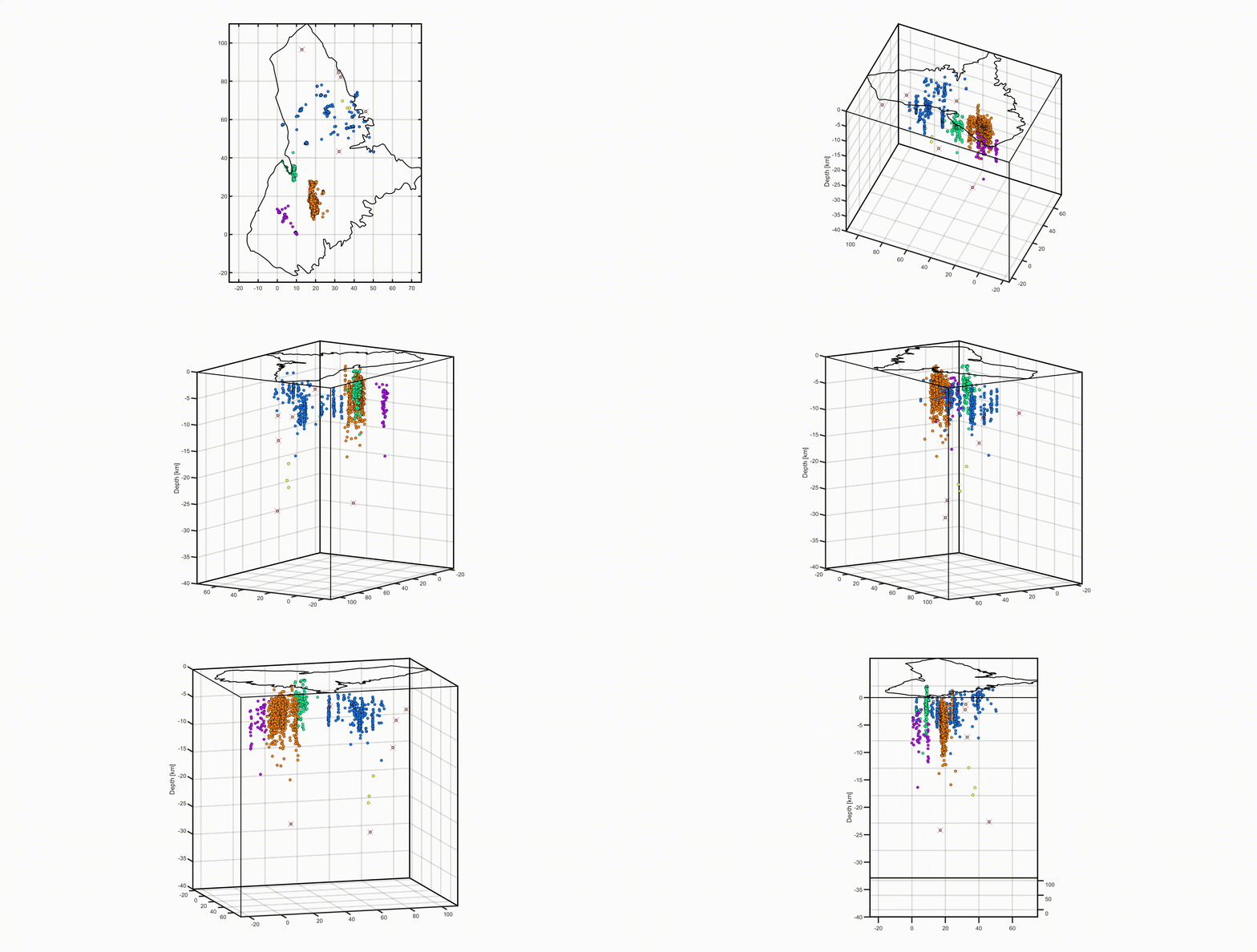
I created this simple rendering and 3D diagram of the earthquakes in my research field site - Raton Basin, Colorado. I used a clustering algorithm in MATLAB to group the earthquakes and visualize different fault lineations. [View Code]
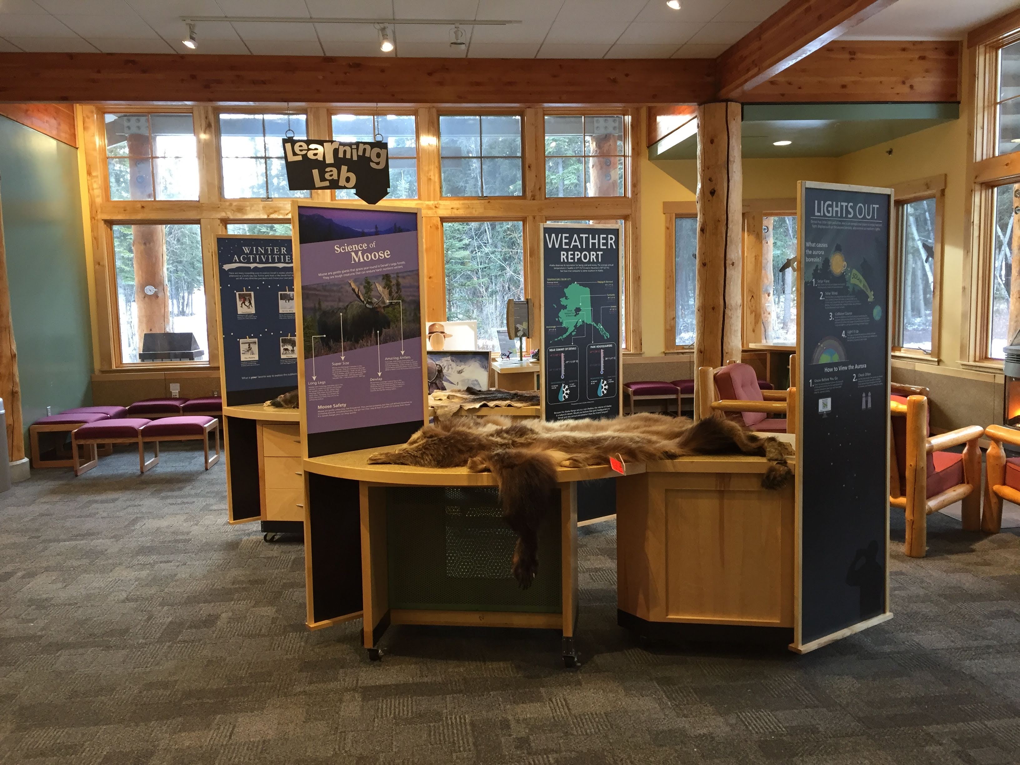
I made exhibits for the Murie Science & Learning Center to showcase various topics such as the Aurora Borealis, Mount Denali, etc. [View Here]
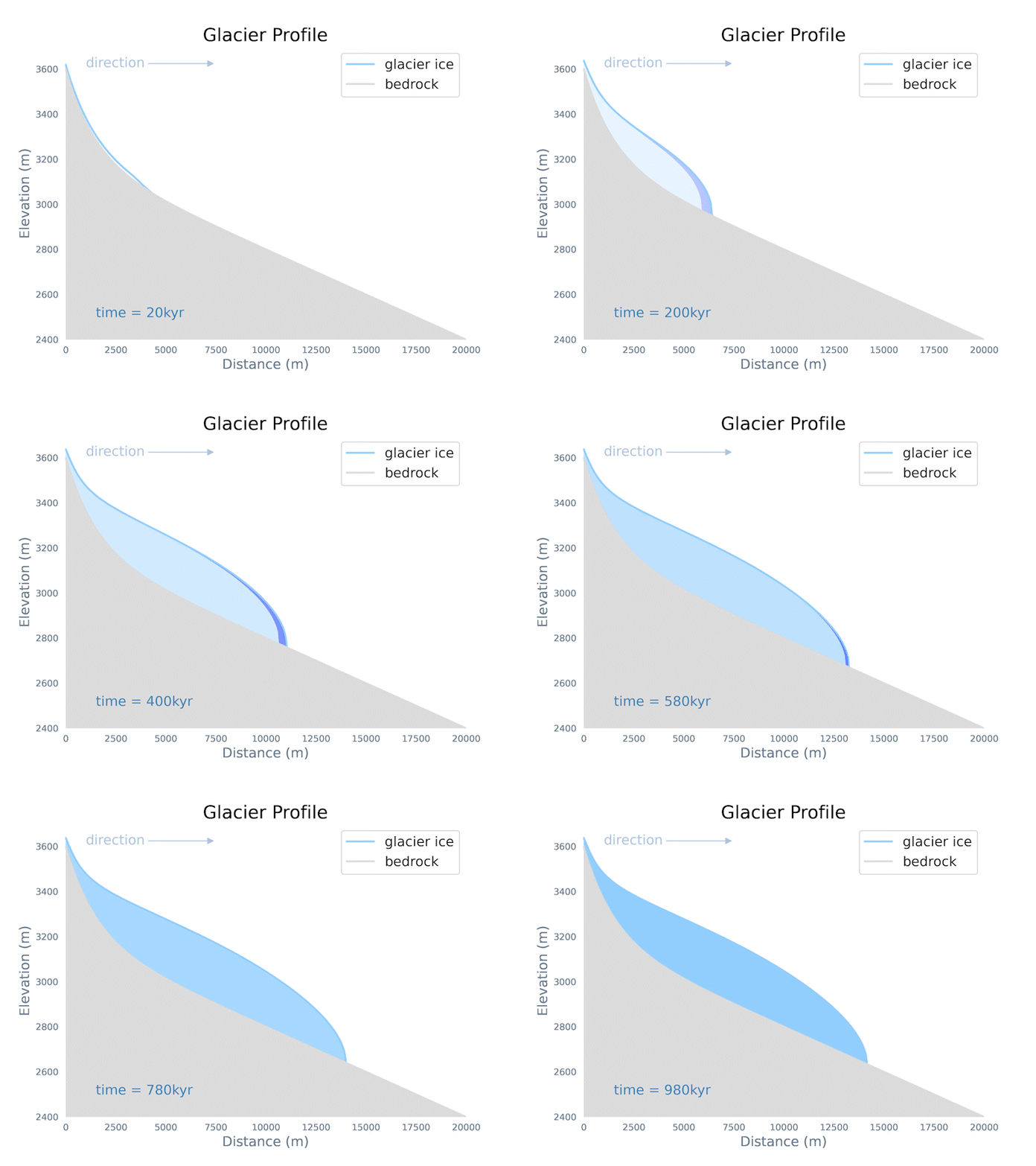
I created this model in order to simulate the growth, equilibrium, and oscillation of a valley glacier. [View Code]
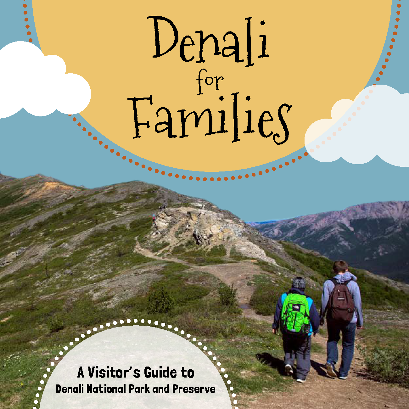
This free travel guide is designed for parents and guardians who are traveling to Denali and hope to make lasting memories. [View digital PDF]
- Book 2025
Top 20 Essential Skills for Imagery and Remote Sensing
Esri PressContributing author on the SAR chapter, covering radar fundamentals through vegetation and water extraction in ArcGIS Pro.
- Conference 2025
Integrating SAR and Earth observation into GIS-based decision support
IEEE IGARSSPresenter at the International Geoscience and Remote Sensing Symposium.
- Plenary 2024
Estimating vegetation biomass and wildfire CO₂ emissions
Esri Developer & Technology SummitPlenary talk on scalable raster analytics over Microsoft Planetary Computer imagery, using STAC support in the ArcGIS API for Python.
- Teaching 2023–2025
Imagery & Remote Sensing MOOC
EsriInstructor and content contributor: image analysis, image services, multidimensional data and applied remote sensing.
- Talk 2024–2026
Graphic Design for Scientists
InvitedOn visual hierarchy and audience-centred scientific communication, alongside ongoing blogs, tutorials, StoryMaps and workshops for the Esri imagery community.
- Poster 2021
Geodetic Techniques Applied Towards Understanding Induced Earthquakes in Raton Basin
American Geophysical UnionTechnical poster on Sentinel-1 InSAR results from the Raton Basin, New Orleans, LA.
- Book 2018
Denali for Families: A Visitor's Guide
National Park Service & Alaska GeographicEditor and illustrator of a children's guide to Denali National Park and Preserve.
Some designs I have created to bring scince together with beautiful art.
My first portfolio website I designed and built and learned a lot about HTML, CSS/SCSS, JavaScript and Git.